Γεια σας, καλώς ήρθατε στη σελίδα Zakynthos Uncovered.
This is Greek and means: Hello, welcome to Zakynthos Uncovered.
Zakynthos, auch Fior di Levante (Blume des Ostens) genannt, ist die südlichste der größeren Ionischen Insel und liegt im Ionischen Meer. Auf dieser Seite präsentiere wir euch die Schönheit der Insel, besonders sehenswerte Orte, Strände, Landschaften inkl. Infos zum Besuch, wie Anfahrtsbeschreibungen, Parkmöglichkeiten aber auch Tipps für fotografische Aufnahmen.
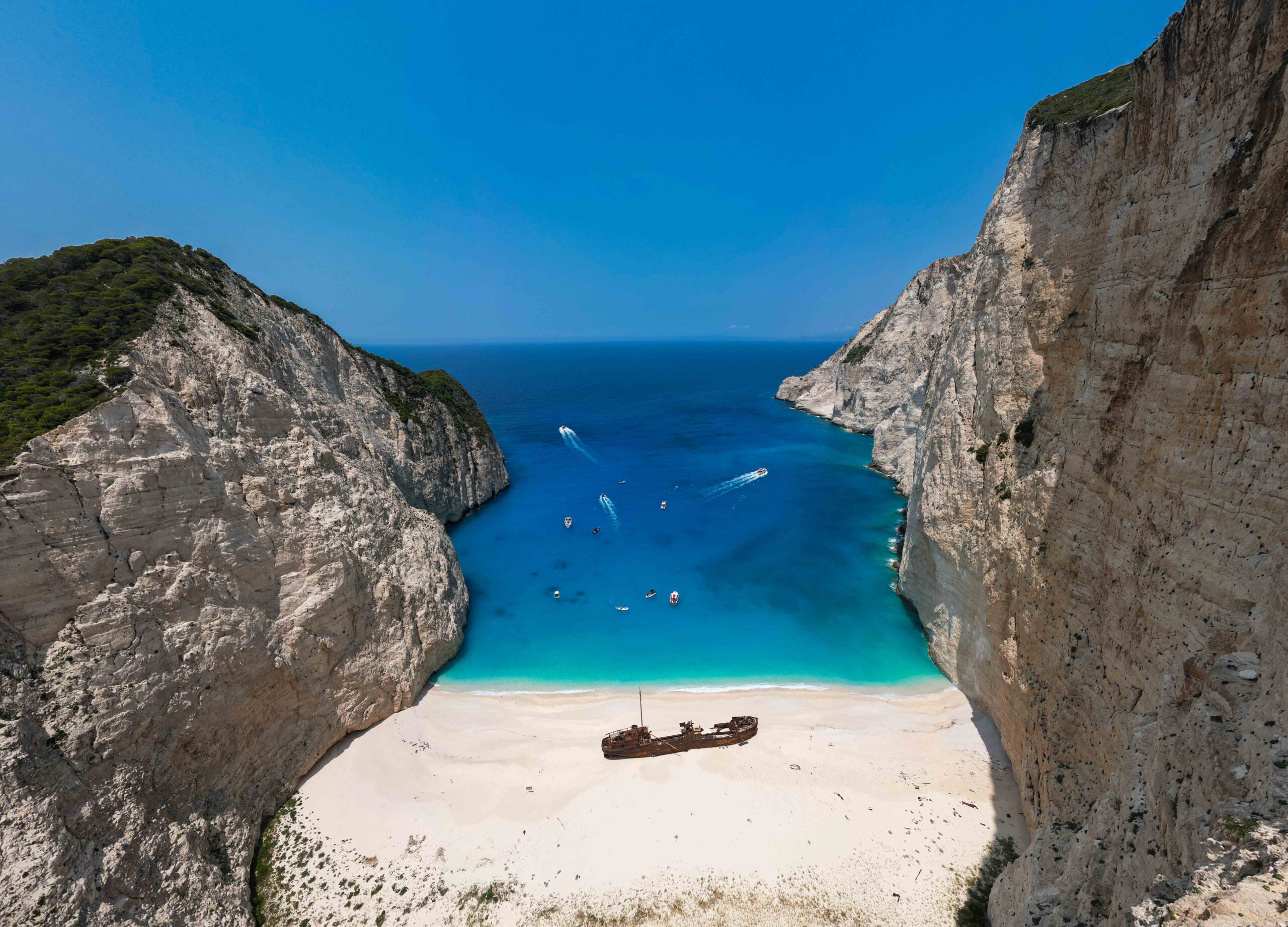
The Ionian Islands were formed during the folding of the Alps by the collision of the Eurasian and African continental plates. The island can be roughly divided into two landscapes along a longitudinal axis from northwest to southeast: In the north and west of the country there is a mountain massif, the coast of which drops steeply, in places up to 200 m. To the east of this mountain massif there is a large flatland plain, which only has a few other elevations near the coast. In the south of the island is the crescent-shaped bay of Laganas, which is a preferred nesting area for the loggerhead sea turtle (Caretta Caretta).
To the west of Zakynthos lies the so-called Hellenic Rift, which was created by the collision of the Eurasian and African continental plates and is one of the deepest parts of the Mediterranean at 4,000 m deep. Due to Zakynthos‘ proximity to this active tectonic plate boundary, earthquakes and, often occur on Zakynthos. As a result also Tsunamis possibly occur. For example, the island of Agios Sostis was separated from the mainland by a tsunami. We have visited the island several times and have been woken up by earthquakes at night.